Kakara Island
Discover Kakara, where every breath of nature echoes through a vibrant cultural legacy
Kakara Island Experience: Culture and Coast
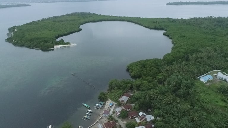
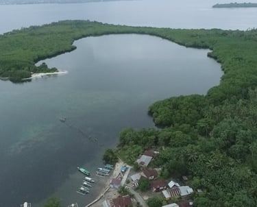
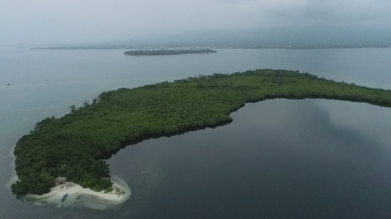
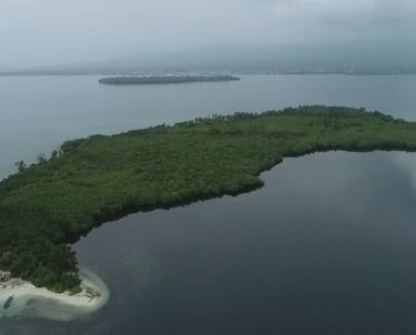
Step into the serenity of Kakara Island as lush coastal forests blend with clear turquoise waters, offering a peaceful escape from the distractions of modern life. Located in the heart of North Maluku, Kakara presents more than a tropical destination. It stands as a living expression of cultural heritage, ecological richness, and historical significance. Visitors are invited to discover secluded beaches, experience traditional practices passed down through generations, and engage with nature in its most authentic form. From sustainable nature trails to meaningful encounters with local communities, every journey through Kakara unfolds as a memorable and inspiring experience.
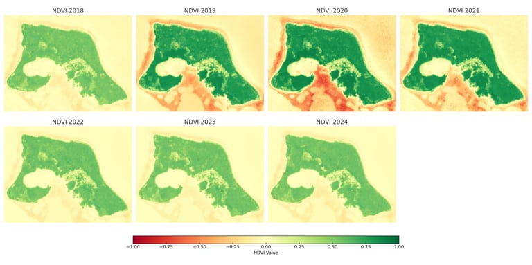
NDVI Monitoring (2018–2024)
The Normalized Difference Vegetation Index (NDVI) provides critical insight into vegetation health and ecosystem stability. The temporal visualization illustrates dynamic changes in greenness across Kakara Island. Higher NDVI values (closer to green) signify more vigorous and healthy vegetation.
📊 Key Observations:
2018–2019: Relatively stable vegetation distribution, with dense coverage along the central and southern parts of the island.
2020–2022: Noticeable decline in NDVI, especially near the coastline and in southern fringes, potentially caused by climatic dryness, land-use disturbances, or edge effects.
2023–2024: Gradual recovery of vegetative health, particularly evident in the northern and central zones, indicating ecological resilience or regrowth efforts.

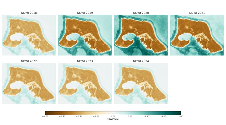
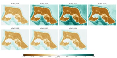
NDWI Monitoring (2018–2024)
Normalized Difference Water Index (NDWI) highlights water bodies and soil moisture. This helps in identifying hydrological shifts, particularly in mangrove areas, wetlands, and coastal buffer zones.
📊 Key Observations:
A gradual increase in surface moisture is visible post-2021, suggesting potential hydrological recovery or rewetting of previously dry zones.
Drier patterns observed during 2020–2021 spatially correlate with NDVI decline, indicating possible vegetation stress or seasonal dryness.
Wet conditions in 2023–2024 appear to stabilize, which may support mangrove regeneration efforts in the region.
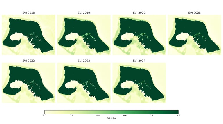
Enhanced Vegetation Index (EVI) provides refined insights into vegetation dynamics by correcting for canopy background and atmospheric influences. This index is especially useful in densely vegetated areas such as Tagalaya Island. The visualization reveals temporal fluctuations in vegetation health over a seven-year period:
📊 Key Observations:
2018–2019: Consistently high vegetation density across the island, with minimal fluctuations.
2020–2022: Moderate decline in vegetation intensity, particularly in southern coastal zones, potentially due to stress events or seasonal impacts.
2023–2024: Marked improvement in EVI values, indicating regrowth and ecological resilience, especially in central and eastern areas.
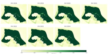
EVI Monitoring (2018–2024)
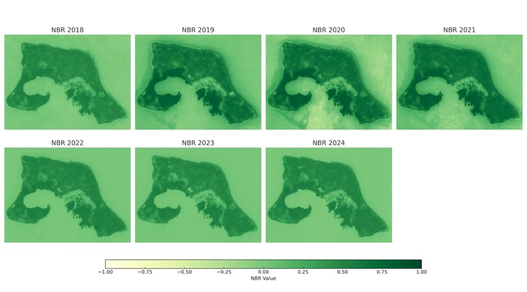
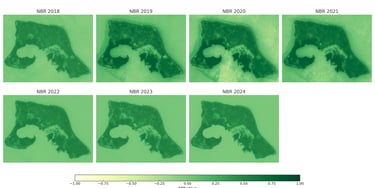
Normalized Burn Ratio (NBR) is a spectral index designed to detect burned areas, post-fire regrowth, and vegetation stress. It is especially effective in monitoring ecological disturbances and recovery in coastal and forested ecosystems such as Kakara Island. The visualization illustrates temporal variations in NBR values over seven years.
📊 Key Observations:
2018–2019: Stable NBR values across most regions, indicating limited disturbance or fire-related stress.
2020–2022: Noticeable decline in NBR in central and southern areas, possibly reflecting vegetation stress, degradation, or hydrological shifts.
2023–2024: Gradual improvement in NBR values, suggesting early signs of ecological recovery or stabilization, especially near mangrove edges and lowland zones.
NBR Monitoring (2018–2024)
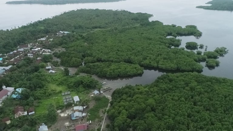
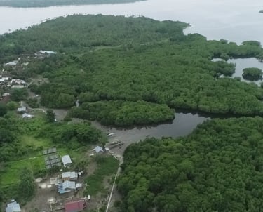
Ground Verification using Aerial Drone Videography